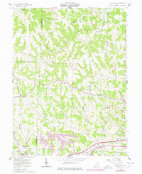
1962 Map of Bloomfield
USGS Topo · Published 1978About this map
The rolling landscape of eastern Ohio is defined here by the headwaters of Wills Creek Lake and the complex drainage of Indian Camp Run and Peters Creek. The southern edge of the map highlights the academic and industrial development around New Concord, including the campus of Muskingum College and the John H Glenn High School. This area shows a distinct shift from the agricultural and extractive patterns further north, where Strip Mines and scattered Gas Wells dot the hills between Adams and Union townships.
Find a feature on this map
42 named features on this map. Tap any name to fly to it.
Don’t see what you’re looking for? This feature index may not catch every label — zoom into the map to look around manually.
Map Details
Editions of this 1962 Bloomfield Map
4 editions found
Other maps of this area

1908 · Conesville
USGS Topo · 1:62,500

1909 · Cambridge
USGS Topo · 1:62,500

1910 · Philo
USGS Topo · 1:62,500

1910 · Conesville
USGS Topo · 1:62,500

1911 · Cumberland
USGS Topo · 1:62,500

1912 · Cambridge
USGS Topo · 1:62,500

1949 · Clarksburg
USGS Topo · 1:250,000

1951 · Canton
USGS Topo · 1:250,000

1953 · Canton
USGS Topo · 1:250,000

1956 · Clarksburg
USGS Topo · 1:250,000