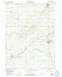
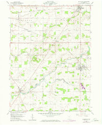
1960 Map of Bloomville
USGS Topo · Published 1992About this map
Bloomville and the surrounding Seneca County countryside appear in this survey as a landscape defined by traditional agricultural boundaries and a dual-railroad economy. The town of Republic anchors the northern edge, while the village of Melmore sits to the southwest along the winding course of Honey Creek. This era captures the transition of the local rail lines, with both the Baltimore and Ohio and the Penn Central railroads cutting through the township grids of Clinton, Scipio, Eden, and Bloom.
Find a feature on this map
24 named features on this map. Tap any name to fly to it.
Don’t see what you’re looking for? This feature index may not catch every label — zoom into the map to look around manually.
Map Details
Editions of this 1960 Bloomville Map
5 editions found
Other maps of this area

1906 · Sycamore
USGS Topo · 1:62,500

1906 · Tiffin
USGS Topo · 1:62,500

1915 · Siam
USGS Topo · 1:62,500

1915 · Bucyrus
USGS Topo · 1:62,500

1943 · Bucyrus
USGS Topo · 1:62,500

1950 · Marion
USGS Topo · 1:250,000

1956 · Toledo
USGS Topo · 1:250,000

1960 · Sycamore
USGS Topo · 1:24,000
1960 · Watson
USGS Topo · 1:24,000

1960 · Tiffin South
USGS Topo · 1:24,000