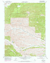
1952 Map of Blossom
USGS Topo · Published 1970About this map
Blossom sits at the junction of several drainage systems in this northern California landscape, where the seasonal flows of Liza Creek and Reeds Creek converge. The topography is defined by the broad expanse of Burr Valley to the south and a complex network of ridges to the north, including the high ground at Montgomery Lookout. This 1950s survey, updated with late-1960s photogrammetry, reveals a rural economy based on water management and ranching, evidenced by scattered reservoirs, a Windmill, and a network of unimproved roads and jeep trails. To the north, the South Fork of Cottonwood Creek marks the boundary of a terrain carved by numerous tributaries like Hooker Creek and North Fork Dibble Creek. The map documents the physical infrastructure of the era, such as a major Pipeline cutting through the northwest and numerous benchmark locations that established the precise elevation of this interior valley region.
Find a feature on this map
43 named features on this map. Tap any name to fly to it.
Don’t see what you’re looking for? This feature index may not catch every label — zoom into the map to look around manually.
Map Details
Editions of this 1952 Blossom Map
5 editions found
Other maps of this area

1890 · Red Bluff
USGS Topo · 1:250,000

1894 · Red Bluff
USGS Topo · 1:250,000

1947 · Anderson
USGS Topo · 1:62,500

1948 · Anderson
USGS Topo · 1:62,500

1949 · Colyear Springs
USGS Topo · 1:62,500

1951 · West of Gerber
USGS Topo · 1:24,000

1951 · Red Bluff West
USGS Topo · 1:24,000

1952 · Blossom
USGS Topo · 1:24,000

1952 · Red Bank
USGS Topo · 1:24,000

1952 · Ono
USGS Topo · 1:62,500