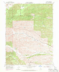
1952 Map of Blossom
USGS Topo · Published 1971About this map
Blossom sits at the heart of this ranching and grazing landscape in Tehama County, where a network of watercourses defines the terrain's character. The drainage patterns of South Fork Cottonwood Creek and Reeds Creek cut across the hills, while Burr Valley provides a distinct geographical pocket in the southern portion of the quadrangle. Early infrastructure is evident through the path of Beegum Road and the established route of Johnson Road, connecting isolated ranch points like Gonsalves. The presence of the Montgomery Lookout indicates the importance of fire observation over the surrounding timber and brush lands. Numerous reservoirs and windmills scattered throughout the survey suggest the vital role of water management for livestock in this rural California interior, long before suburban development altered the region.
Find a feature on this map
31 named features on this map. Tap any name to fly to it.
Don’t see what you’re looking for? This feature index may not catch every label — zoom into the map to look around manually.
Map Details
Editions of this 1952 Blossom Map
5 editions found
Other maps of this area

1890 · Red Bluff
USGS Topo · 1:250,000

1894 · Red Bluff
USGS Topo · 1:250,000

1947 · Anderson
USGS Topo · 1:62,500

1948 · Anderson
USGS Topo · 1:62,500

1949 · Colyear Springs
USGS Topo · 1:62,500

1951 · West of Gerber
USGS Topo · 1:24,000

1951 · Red Bluff West
USGS Topo · 1:24,000

1952 · Blossom
USGS Topo · 1:24,000

1952 · Red Bank
USGS Topo · 1:24,000

1952 · Ono
USGS Topo · 1:62,500