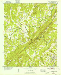
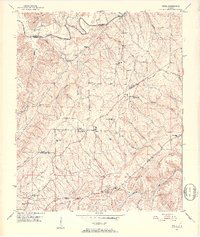
1951 Map of Blount Springs
USGS Topo · Published 1952About this map
Blount Springs sits at the heart of this mid-century landscape, positioned where the Louisville and Nashville railroad cuts through the mountainous corridor between Duffy Mountain and Hayden Mountain. The settlement pattern follows the narrow valleys and ridges, with family-named landmarks like Huffman Mountain and Barefoot Mountain overlooking small communities and rural congregations such as Mountain Brook Ch and New Union Ch.
Find a feature on this map
45 named features on this map. Tap any name to fly to it.
Don’t see what you’re looking for? This feature index may not catch every label — zoom into the map to look around manually.
Map Details
Editions of this 1951 Blount Springs Map
5 editions found
Other maps of this area

1888 · Cullman
USGS Topo · 1:125,000

1889 · Birmingham
USGS Topo · 1:125,000

1892 · Cullman
USGS Topo · 1:125,000

1892 · Birmingham
USGS Topo · 1:125,000

1895 · Birmingham
USGS Topo · 1:125,000

1907 · Birmingham
USGS Topo · 1:125,000

1951 · Arkadelphia
USGS Topo · 1:24,000

1951 · Warrior
USGS Topo · 1:24,000
1951 · Creel
USGS Topo · 1:24,000

1951 · Blount Springs
USGS Topo · 1:24,000