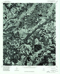
1975 Map of Blountsville
USGS Topo · Published 1977About this map
Blountsville serves as the primary hub of this north-central Alabama landscape, captured through orthophotography in the mid-1970s. The aerial perspective, produced in cooperation with the Soil Conservation Service, highlights a complex mosaic of agricultural clearings and dense woodland. To the east, the smaller settlement of Royal sits amidst a pattern of sharp ridges and deep valleys that define the local topography. This orthophotoquad is particularly useful for observing how the rural road network and property lines were influenced by the winding watercourses and steep terrain of the Blount County area during this period, providing a clear record of land use before more modern development altered the rural character of the region.
Find a feature on this map
2 named features on this map. Tap any name to fly to it.
Don’t see what you’re looking for? This feature index may not catch every label — zoom into the map to look around manually.
Map Details
Editions of this 1975 Blountsville Map
2 editions found
Other maps of this area

1885 · Gadsden
USGS Topo · 1:125,000

1888 · Cullman
USGS Topo · 1:125,000

1888 · Gadsden
USGS Topo · 1:125,000

1889 · Springville
USGS Topo · 1:125,000

1889 · Birmingham
USGS Topo · 1:125,000

1892 · Cullman
USGS Topo · 1:125,000

1892 · Birmingham
USGS Topo · 1:125,000

1892 · Springville
USGS Topo · 1:125,000

1892 · Gadsden
USGS Topo · 1:125,000

1895 · Gadsden
USGS Topo · 1:125,000