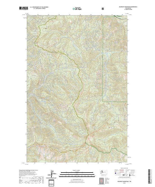
2023 Map of Blowout Mountain
USGS Topo · Published 2023About this map
Blowout Mountain and the surrounding high ridges of the Cascade Range define this boundary region between King and Kittitas counties. The landscape is a network of watersheds where the Green River flows westward and Cabin Creek drains toward the Yakima basin. This map documents a high-altitude wilderness split between the Wenatchee National Forest and the Snoqualmie National Forest, connected by a complex system of mountain passes including Sheets Pass, Tacoma Pass, and Green Pass. The legendary Pacific Crest National Scenic Trail winds through the center of the sheet, tracing the spine of the divide. Historical travel and modern recreation paths intersect throughout, from the John Wayne Trail in the north to the Greenwater-Naches Trail and Blowout Mountain Trail further south, illustrating the enduring importance of these corridors.
Find a feature on this map
48 named features on this map. Tap any name to fly to it.
Don’t see what you’re looking for? This feature index may not catch every label — zoom into the map to look around manually.
Map Details
Editions of this 2023 Blowout Mountain Map
This is the sole edition of this map. No revisions or reprints were ever made.
Other maps of this area

1901 · Snoqualmie Pass
USGS Topo · 1:125,000

1903 · Snoqualmie
USGS Topo · 1:125,000

1957 · Wenatchee
USGS Topo · 1:250,000

1961 · Snoqualmie Pass
USGS Topo · 1:62,500

1961 · Easton
USGS Topo · 1:62,500

1961 · Kachess Lake
USGS Topo · 1:62,500

1962 · Lester
USGS Topo · 1:62,500

1975 · Snoqualmie Pass
USGS Topo · 1:100,000

1989 · Easton
USGS Topo · 1:24,000
1989 · Raven Roost
USGS Topo · 1:24,000