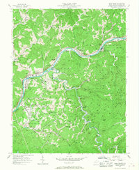
1957 Map of Blue Creek
USGS Topo · Published 1968About this map
The Elk River and Big Sandy River define the industrial and social life of this West Virginia landscape during the mid-1950s. The region is heavily marked by the energy sector, with a dense concentration of oil wells and complex pipeline networks crisscrossing the steep terrain. At the confluence of these waterways and rail lines, the Falling Rock Refinery serves as a major hub near Falling Rock Creek. Small communities like Elkview and Blue Creek follow the river bends, while interior ridges such as Flatwood Ridge host more isolated landmarks like the Pinch Ridge Ch.
Find a feature on this map
72 named features on this map. Tap any name to fly to it.
Don’t see what you’re looking for? This feature index may not catch every label — zoom into the map to look around manually.
Map Details
Editions of this 1957 Blue Creek Map
4 editions found
Other maps of this area

1897 · Kanawha Falls
USGS Topo · 1:125,000

1899 · Charleston
USGS Topo · 1:125,000

1900 · Kanawha Falls
USGS Topo · 1:125,000

1901 · Kanawha Falls
USGS Topo · 1:125,000

1906 · Kenna
USGS Topo · 1:62,500

1906 · Walton
USGS Topo · 1:62,500

1907 · Kenna
USGS Topo · 1:62,500

1907 · Walton
USGS Topo · 1:62,500

1907 · Clendenin
USGS Topo · 1:62,500

1909 · Charleston
USGS Topo · 1:62,500