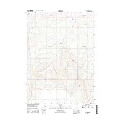
2015 Map of Blue Gulch
USGS Topo · Published 2015About this map
Beaver Rim and Rock Creek Mtn dominate the southern landscape of this Fremont County quadrangle, where the terrain breaks sharply across the high desert. The map captures a sophisticated network of seasonal drainages and springs that have long dictated movement through this arid environment. Primary watercourses including Oil Springs Cr, Conant Cr, and Rock Cr carve through the sedimentary layers, creating features like Blue Gulch and Boiler Draw. Human imprints are primarily limited to ranching infrastructure, specifically Poston Ranch Rd and Oil Springs Rd, which provide access to reliable water sources such as Cogswell Spring and Moone Spring. This 2015 data reflects the enduring ranching character of the region, showing how modern land management still aligns with the natural geography of Blue Ridge and its surrounding draws.
Find a feature on this map
21 named features on this map. Tap any name to fly to it.
Don’t see what you’re looking for? This feature index may not catch every label — zoom into the map to look around manually.
Map Details
Editions of this 2015 Blue Gulch Map
This is the sole edition of this map. No revisions or reprints were ever made.
Other maps of this area

1952 · Tin Cup Mountain
USGS Topo · 1:24,000

1952 · Double Butte
USGS Topo · 1:24,000

1952 · Rongis Reservoir
USGS Topo · 1:24,000

1953 · Blue Gulch
USGS Topo · 1:24,000

1953 · Elkhorn Springs
USGS Topo · 1:24,000

1953 · Campbell Ridge
USGS Topo · 1:24,000

1953 · Sand Draw
USGS Topo · 1:24,000

1953 · Dishpan Butte
USGS Topo · 1:24,000

1955 · Lander
USGS Topo · 1:250,000

1955 · Casper
USGS Topo · 1:250,000