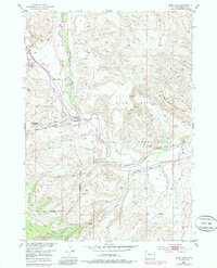
1952 Map of Blue Holes
USGS Topo · Published 1985About this map
The Wind River Indian Reservation dominates this mid-century topographic record, where the Wind River meets its East Fork Wind River. The landscape is defined by the sharp transition from the river valley floor to high plateaus like Table Mountain. Human activity is clustered primarily along the river corridors, marked by infrastructure such as a Landing Strip and the State Game and Fish Checking Station.
Find a feature on this map
18 named features on this map. Tap any name to fly to it.
Don’t see what you’re looking for? This feature index may not catch every label — zoom into the map to look around manually.
Map Details
Editions of this 1952 Blue Holes Map
4 editions found
Other maps of this area

1904 · Kirwin
USGS Topo · 1:125,000

1905 · Younts Peak
USGS Topo · 1:125,000

1906 · Kirwin
USGS Topo · 1:125,000

1907 · Younts Peak
USGS Topo · 1:125,000

1909 · Fremont Peak
USGS Topo · 1:125,000

1952 · Wilderness
USGS Topo · 1:24,000

1952 · Hays Park
USGS Topo · 1:24,000

1952 · Blue Holes
USGS Topo · 1:24,000

1952 · Burris
USGS Topo · 1:24,000

1955 · Thermopolis
USGS Topo · 1:250,000