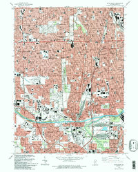
1993 Map of Blue Island
USGS Topo · Published 1993About this map
Industrial waterways and extensive cemetery grounds define the landscape of south Chicago and its suburbs in the early 1990s. The Calumet Sag Canal and Little Calumet River cut through the lower portion of the sheet, providing a vital corridor for commerce and drainage. To the north, the densely gridded residential streets of Evergreen Park and Oak Lawn are punctuated by significant institutional landmarks like St Xavier College and Christ Hospital. Large tracts of land remain dedicated to perpetual care, including the expansive St Marys Cemetery and Burr Oak Cemetery. This era shows a fully developed suburban network where rail lines like the Illinois Central Gulf RR and Grand Trunk Western RR intersect with residential growth and preserved natural areas like the Wolfe State Wildlife Refuge.
Find a feature on this map
74 named features on this map. Tap any name to fly to it.
Don’t see what you’re looking for? This feature index may not catch every label — zoom into the map to look around manually.
Map Details
Editions of this 1993 Blue Island Map
2 editions found
Other maps of this area

1889 · Chicago
USGS Topo · 1:62,500

1890 · Des Plaines
USGS Topo · 1:62,500

1891 · Chicago
USGS Topo · 1:62,500

1891 · Riverside
USGS Topo · 1:62,500

1892 · Calumet
USGS Topo · 1:62,500

1893 · Calumet
USGS Topo · 1:62,500

1893 · Riverside
USGS Topo · 1:62,500

1894 · Des Plaines
USGS Topo · 1:62,500

1900 · Chicago
USGS Topo · 1:62,500

1900 · Des Plaines
USGS Topo · 1:62,500