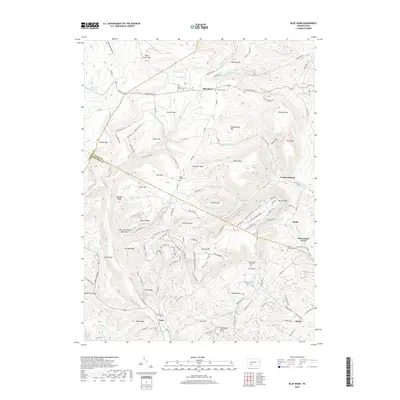
2019 Map of Blue Knob
USGS Topo · Published 2019About this map
Pavia and the surrounding high ground of the Allegheny Front define this 2019 survey, where steep ridges and deep hollows dictate the layout of small settlements. A unique point of local lore is the Lost Cox Children Monument, marking a specific historical event in these woods. The landscape is characterized by a series of prominent peaks and ridges including Blue Knob, Schaefer Head, and Miller Mtn, while the drainage system of Bobs Cr and Beaverdam Cr cuts through the terrain. Numerous family and community burial sites are documented across the sheet, such as Mount Zion Cem and Upper Claar Cem. In the east, the small communities of Queen and Klahr sit at lower elevations, connected by roads that wind around the massive landforms of the Blue Knob massif and Ritchey Knob.
Find a feature on this map
135 named features on this map. Tap any name to fly to it.
Don’t see what you’re looking for? This feature index may not catch every label — zoom into the map to look around manually.
Map Details
Editions of this 2019 Blue Knob Map
This is the sole edition of this map. No revisions or reprints were ever made.
Other maps of this area

1900 · Everett
USGS Topo · 1:62,500

1902 · Everett
USGS Topo · 1:62,500

1902 · Ebensburg
USGS Topo · 1:62,500

1902 · Hollidaysburg
USGS Topo · 1:62,500

1903 · Hollidaysburg
USGS Topo · 1:62,500

1904 · Ebensburg
USGS Topo · 1:62,500

1908 · Bedford
USGS Topo · 1:62,500

1910 · Bedford
USGS Topo · 1:62,500

1953 · Pittsburgh
USGS Topo · 1:250,000

1954 · Pittsburgh
USGS Topo · 1:250,000
Featured Places
- Pavia Township, PA
- Washington Township, PA
- Blue Knob, Juniata Township
- Juniata Township, PA
- Summerhill Township, PA