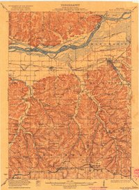
1922 Map of Blue Mounds
USGS Topo · Published 1922About this map
The Wisconsin River corridor dominates this 1922 survey, carving through the landscape past Ferry Bluff and Cedar Island. This region, documented by O.H. Nelson and other topographers, shows a mature rural infrastructure defined by an exceptional density of country schools. From the Seitz School in the north to the Erbe School near the southern border, these institutions served family farms established throughout Knight Valley and Marsh Valley.
Find a feature on this map
81 named features on this map. Tap any name to fly to it.
Don’t see what you’re looking for? This feature index may not catch every label — zoom into the map to look around manually.
Map Details
Editions of this 1922 Blue Mounds Map
3 editions found
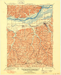
Other maps of this area

1895 · Baraboo
USGS Topo · 1:62,500

1901 · Denzer
USGS Topo · 1:62,500

1902 · Mineral Point
USGS Topo · 1:125,000

1905 · Richland Center
USGS Topo · 1:125,000

1907 · Cross Plains
USGS Topo · 1:62,500

1908 · Baraboo
USGS Topo · 1:62,500

1909 · Cross Plains
USGS Topo · 1:62,500

1920 · Blue Mounds
USGS Topo · 1:62,500

1922 · Blue Mounds
USGS Topo · 1:62,500

1923 · Blanchardville
USGS Topo · 1:62,500