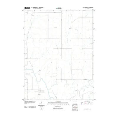
2009 Map of Blue Rapids NE
USGS Topo · Published 2009About this map
Big Blue River and the Black Vermillion River converge in this agricultural region of Marshall County during the early 21st century. The landscape is defined by a rigorous grid of section-line roads, including Sunflower Rd, Tumbleweed Rd, and Zodiac Rd, reflecting the enduring township-and-range surveying system. Several family or community burial sites such as Antioch Cemetery, Saville Cemetery, and Edinborough Cemetery are scattered across the terrain, providing essential landmarks for genealogical research. One of the most distinctive features is the Indian Mound located near the southern boundary, suggesting long-term human presence along the river terraces. Transportation and utility are marked by the Linch Landing Strip and the aptly named RR Ln, while numerous waterways like Corndodger Creek and Perkins Creek drain the surrounding fields into the primary river basins.
Find a feature on this map
32 named features on this map. Tap any name to fly to it.
Don’t see what you’re looking for? This feature index may not catch every label — zoom into the map to look around manually.
Map Details
Editions of this 2009 Blue Rapids NE Map
This is the sole edition of this map. No revisions or reprints were ever made.
Other maps of this area

1889 · Seneca
USGS Topo · 1:125,000

1889 · Marysville
USGS Topo · 1:125,000

1894 · Seneca
USGS Topo · 1:125,000

1894 · Marysville
USGS Topo · 1:125,000

1955 · Manhattan
USGS Topo · 1:250,000

1956 · Manhattan
USGS Topo · 1:250,000

1957 · Manhattan
USGS Topo · 1:250,000

1966 · Marysville
USGS Topo · 1:24,000

1966 · Home
USGS Topo · 1:24,000
1966 · Beattie
USGS Topo · 1:24,000