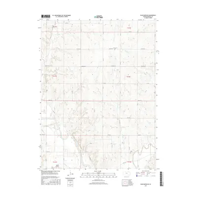
2015 Map of Blue Rapids NE
USGS Topo · Published 2015About this map
The Big Blue River meanders through the southwestern corner of this Marshall County landscape, where it meets the Black Vermillion River and Game Fork. This convergence area is overlooked by a notable Indian Mound south of Zenith Rd. The upland terrain is defined by a grid of rural routes including Sunflower Rd and Tumbleweed Rd, which connect several legacy burial sites. Genealogists can trace family history at the Edinborough Cem, Saville Cem, Antioch Cem, and Elm Creek Cem. The drainage pattern is intricate, with numerous tributaries such as Corndodger Cr, Johnson Fork, and Perkins Cr carving through the prairie hills, reflecting the traditional agricultural layout of the region.
Find a feature on this map
44 named features on this map. Tap any name to fly to it.
Don’t see what you’re looking for? This feature index may not catch every label — zoom into the map to look around manually.
Map Details
Editions of this 2015 Blue Rapids NE Map
This is the sole edition of this map. No revisions or reprints were ever made.
Other maps of this area

1889 · Seneca
USGS Topo · 1:125,000

1889 · Marysville
USGS Topo · 1:125,000

1894 · Seneca
USGS Topo · 1:125,000

1894 · Marysville
USGS Topo · 1:125,000

1955 · Manhattan
USGS Topo · 1:250,000

1956 · Manhattan
USGS Topo · 1:250,000

1957 · Manhattan
USGS Topo · 1:250,000

1966 · Marysville
USGS Topo · 1:24,000

1966 · Home
USGS Topo · 1:24,000
1966 · Beattie
USGS Topo · 1:24,000