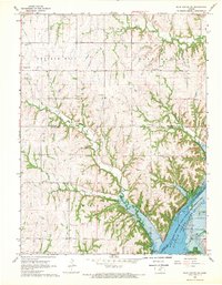
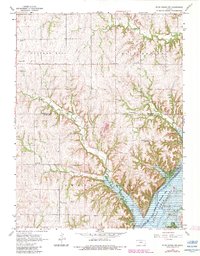
1968 Map of Blue Rapids SW
USGS Topo · Published 1970About this map
The Big Blue River valley and its surrounding uplands are captured here in the late 1960s, a period marked by the significant landscape transformation of the Tuttle Creek Reservoir. The southeastern corner of the map shows the reservoir's reach, including the Tuttle Creek Reservoir State Wildlife Management Area and the Swede Creek Recreation Area. This water-dominated area contrasts with the high, rolling terrain of Cottage Hill and Blue Rapids to the north.
Find a feature on this map
30 named features on this map. Tap any name to fly to it.
Don’t see what you’re looking for? This feature index may not catch every label — zoom into the map to look around manually.
Map Details
Editions of this 1968 Blue Rapids SW Map
2 editions found
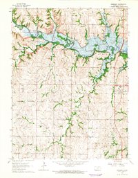
Other maps of this area

1886 · Junction City
USGS Topo · 1:125,000

1889 · Marysville
USGS Topo · 1:125,000

1889 · Junction City
USGS Topo · 1:125,000

1894 · Junction City
USGS Topo · 1:125,000

1894 · Marysville
USGS Topo · 1:125,000

1955 · Manhattan
USGS Topo · 1:250,000

1956 · Manhattan
USGS Topo · 1:250,000

1957 · Manhattan
USGS Topo · 1:250,000
1964 · Randolph
USGS Topo · 1:24,000
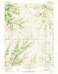
1964 · Olsburg
USGS Topo · 1:24,000