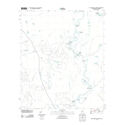
2011 Map of Blue Springs Landing
USGS Topo · Published 2011About this map
Blue Springs and its namesake Blue Springs Landing anchor the southern reaches of this landscape along the Savannah River, where the Georgia-South Carolina border follows the river's winding path. The terrain is defined by an intricate network of waterways and managed ponds, including the precisely named Blake Plantation Pond Number Two D-2608 Dam and Borken Pond Dam. Local history is preserved at the Bryan Cemetery, situated near the junction of Poor Robin Rd and Painters Rd. The river corridor itself is marked by specialized points and cutoffs such as Poor Robin Upper Cut Point and Cutoff Number Ten, reflecting the complex hydrology and navigation history of the Savannah. Inland, family-named landmarks like Noonan Pond, Edwards Pond, and Carlton Pond dot the drainage basins of Black Creek and Jackson Branch, illustrating decades of rural land use and water management.
Find a feature on this map
63 named features on this map. Tap any name to fly to it.
Don’t see what you’re looking for? This feature index may not catch every label — zoom into the map to look around manually.
Map Details
Editions of this 2011 Blue Springs Landing Map
This is the sole edition of this map. No revisions or reprints were ever made.
Other maps of this area

1918 · Oliver
USGS Topo · 1:62,500

1919 · Shirley
USGS Topo · 1:62,500

1920 · Hilltonia
USGS Topo · 1:62,500

1920 · Oliver
USGS Topo · 1:62,500

1920 · Peeples
USGS Topo · 1:62,500

1943 · Hilltonia
USGS Topo · 1:62,500

1943 · Peeples
USGS Topo · 1:62,500

1943 · Shirley
USGS Topo · 1:62,500

1943 · Millen
USGS Topo · 1:125,000

1943 · Oliver
USGS Topo · 1:62,500