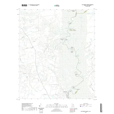
2020 Map of Blue Springs Landing
USGS Topo · Published 2020About this map
Blue Springs Landing serves as the focal point of this low-lying riverine landscape, where the Savannah River winds along the border of Georgia and South Carolina. The terrain is defined by its complex hydrology, featuring numerous oxbows, cutoffs, and family-named points like Thompsons Cut Point and Jacob Jump Point. This intricate network of water suggests a long history of navigation and seasonal flooding, especially within the expansive Moon Change Swamp and along Cornhouse Reach.
Find a feature on this map
72 named features on this map. Tap any name to fly to it.
Don’t see what you’re looking for? This feature index may not catch every label — zoom into the map to look around manually.
Map Details
Editions of this 2020 Blue Springs Landing Map
This is the sole edition of this map. No revisions or reprints were ever made.
Other maps of this area

1918 · Oliver
USGS Topo · 1:62,500

1919 · Shirley
USGS Topo · 1:62,500

1920 · Hilltonia
USGS Topo · 1:62,500

1920 · Oliver
USGS Topo · 1:62,500

1920 · Peeples
USGS Topo · 1:62,500

1943 · Hilltonia
USGS Topo · 1:62,500

1943 · Peeples
USGS Topo · 1:62,500

1943 · Shirley
USGS Topo · 1:62,500

1943 · Millen
USGS Topo · 1:125,000

1943 · Oliver
USGS Topo · 1:62,500