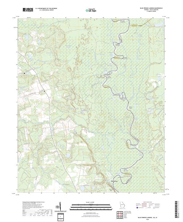
2024 Map of Blue Springs Landing
USGS Topo · Published 2024About this map
The Savannah River defines the border between Georgia and South Carolina in this region, creating a complex network of wetlands and oxbows. The river's winding path is marked by distinctive navigation and landing points such as Poor Robin Cutoff Number Ten, Mosquito Camp Cutoff, and Thompsons Cut Point. These features indicate a landscape heavily influenced by the shifting river channel and its seasonal floods. Inland, the terrain transitions to swamps and ponds with descriptive names like Moon Change Swamp and Stink Pond.
Find a feature on this map
75 named features on this map. Tap any name to fly to it.
Don’t see what you’re looking for? This feature index may not catch every label — zoom into the map to look around manually.
Map Details
Editions of this 2024 Blue Springs Landing Map
This is the sole edition of this map. No revisions or reprints were ever made.
Other maps of this area

1918 · Oliver
USGS Topo · 1:62,500

1919 · Shirley
USGS Topo · 1:62,500

1920 · Hilltonia
USGS Topo · 1:62,500

1920 · Oliver
USGS Topo · 1:62,500

1920 · Peeples
USGS Topo · 1:62,500

1943 · Hilltonia
USGS Topo · 1:62,500

1943 · Peeples
USGS Topo · 1:62,500

1943 · Shirley
USGS Topo · 1:62,500

1943 · Millen
USGS Topo · 1:125,000

1943 · Oliver
USGS Topo · 1:62,500