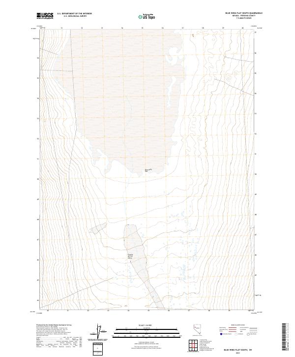
2021 Map of Blue Wing Flat South
USGS Topo · Published 2021About this map
Blue Wing Flat dominates the northern reaches of this Pershing County landscape, where the expansive alkali sink and playa terrain characterize the Great Basin environment. In the southern portion of the quadrangle, the dry lake bed gives way to the open stretches of Granite Springs Valley, a region defined by its internal drainage and desert scrub. The map illustrates the geometric precision of the Public Land Survey System, specifically within the boundaries of t27n r27e and t26n r27e, which overlay the shifting basin topography. This 2021 survey traces the modern hydrological and road network across a landscape where water and vegetation are dictated by the underlying geology of these expansive Nevada basins.
Find a feature on this map
7 named features on this map. Tap any name to fly to it.
Don’t see what you’re looking for? This feature index may not catch every label — zoom into the map to look around manually.
Map Details
Editions of this 2021 Blue Wing Flat South Map
This is the sole edition of this map. No revisions or reprints were ever made.
Other maps of this area

1886 · Granite Range
USGS Topo · 1:250,000

1894 · Granite Range
USGS Topo · 1:250,000

1931 · Lovelock
USGS Topo · 1:250,000

1935 · Lovelock
USGS Topo · 1:250,000

1955 · Lovelock
USGS Topo · 1:250,000

1959 · Lovelock
USGS Topo · 1:250,000
1981 · Bluewing Flat South
USGS Topo · 1:24,000

1981 · Bluewing Flat North
USGS Topo · 1:24,000
1981 · Ragged Top Mtn
USGS Topo · 1:24,000
1981 · Bluewing Spring
USGS Topo · 1:24,000