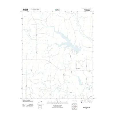
2013 Map of Bluestem Lake
USGS Topo · Published 2013About this map
Bluestem Lake and Pawhuska Lake dominate this Osage County landscape, illustrating the water management and recreation infrastructure of the early 21st century. The map reveals a transition from the rugged topography of Cedar Canyon in the southeast to the broad drainage basins of Bird Cr and its tributaries, including Middle Bird Cr and South Bird Cr. Transportation is defined by a systematic grid of rural routes such as n3660 RD and e0220 RD, which service the agricultural holdings and oil-rich lands of the Osage Nation. Aviation history is represented by the Pawhuska Municipal Airport, situated between the two major reservoirs. The intricate network of creek beds like Clear Cr and Maher Cr shows the natural erosion patterns through the Oklahoma hills, providing a detailed record of the terrain as it appeared before further modern development.
Find a feature on this map
30 named features on this map. Tap any name to fly to it.
Don’t see what you’re looking for? This feature index may not catch every label — zoom into the map to look around manually.
Map Details
Editions of this 2013 Bluestem Lake Map
This is the sole edition of this map. No revisions or reprints were ever made.
Other maps of this area

1909 · Pawhuska
USGS Topo · 1:125,000

1910 · Pawhuska
USGS Topo · 1:125,000

1916 · Foraker
USGS Topo · 1:62,500

1932 · Fairfax
USGS Topo · 1:62,500

1955 · Enid
USGS Topo · 1:250,000

1958 · Enid
USGS Topo · 1:250,000

1960 · Nanos
USGS Topo · 1:24,000

1960 · Pawhuska
USGS Topo · 1:24,000
1964 · Wynona
USGS Topo · 1:24,000
1973 · Happy Hollow
USGS Topo · 1:24,000