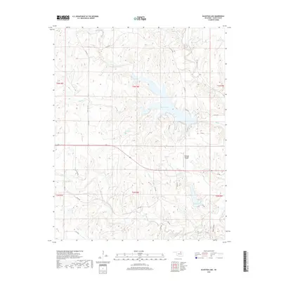
2018 Map of Bluestem Lake
USGS Topo · Published 2018About this map
Bluestem Lake sits at the heart of this Osage County landscape, illustrating the modern water management and infrastructure that defines the region. The map details a sophisticated network of reservoirs, including Lake Pawhuska and several numbered sites such as 113113 Reservoir, which capture the runoff from various tributaries. These waters, including Higgins Cr and Maher Cr, eventually feed into the broader Bird Creek system.
Find a feature on this map
37 named features on this map. Tap any name to fly to it.
Don’t see what you’re looking for? This feature index may not catch every label — zoom into the map to look around manually.
Map Details
Editions of this 2018 Bluestem Lake Map
This is the sole edition of this map. No revisions or reprints were ever made.
Other maps of this area

1909 · Pawhuska
USGS Topo · 1:125,000

1910 · Pawhuska
USGS Topo · 1:125,000

1916 · Foraker
USGS Topo · 1:62,500

1932 · Fairfax
USGS Topo · 1:62,500

1955 · Enid
USGS Topo · 1:250,000

1958 · Enid
USGS Topo · 1:250,000

1960 · Nanos
USGS Topo · 1:24,000

1960 · Pawhuska
USGS Topo · 1:24,000
1964 · Wynona
USGS Topo · 1:24,000
1973 · Happy Hollow
USGS Topo · 1:24,000