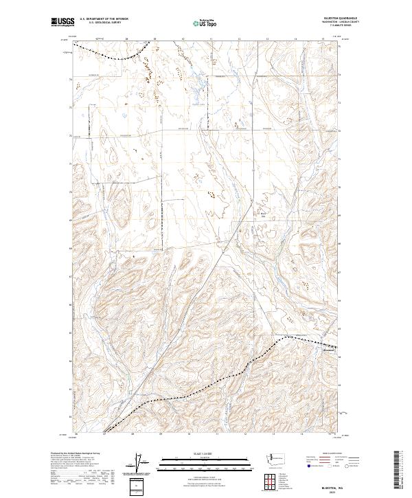
2023 Map of Bluestem
USGS Topo · Published 2023About this map
Bluestem sits at the edge of the undulating plateau country of eastern Washington, marking a landscape defined by seasonal drainages and early farm-to-market routes. The terrain is characterized by broad depressions like Bruns Flat and the elongated Lords Valley, where intermittent water sources such as Lords Creek and Bluestem Creek provide critical drainage for this agricultural region. The mapping reveals a dense network of naming conventions tied to local land ownership and geography, from Tanner Lake in the north to family-named routes like Old Kucks Rd and Star Barn Rd N. The presence of the Harrington Airport Rd on the western edge highlights the region's connection to wider transportation networks, while the section lines and township markers delineate the systematic development of the Lincoln County interior.
Find a feature on this map
37 named features on this map. Tap any name to fly to it.
Don’t see what you’re looking for? This feature index may not catch every label — zoom into the map to look around manually.
Map Details
Editions of this 2023 Bluestem Map
This is the sole edition of this map. No revisions or reprints were ever made.
Other maps of this area

1953 · Ritzville
USGS Topo · 1:250,000

1959 · Ritzville
USGS Topo · 1:250,000

1965 · Ritzville
USGS Topo · 1:250,000

1969 · Bluestem
USGS Topo · 1:24,000

1969 · Harrington
USGS Topo · 1:24,000

1969 · Lords Valley
USGS Topo · 1:24,000
1969 · Mondovi
USGS Topo · 1:24,000

1969 · Rocklyn
USGS Topo · 1:24,000

1969 · Omans
USGS Topo · 1:24,000
1969 · Rocklyn SE
USGS Topo · 1:24,000