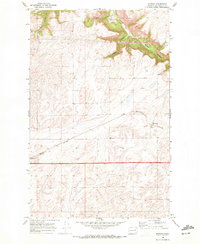
1969 Map of Mondovi
USGS Topo · Published 1972About this map
Mondovi and its surrounding agricultural landscape are the focus of this late-1960s survey, illustrating the critical link between the plateau's grain production and the rail network. The Burlington Northern railroad bisects the terrain, serving the prominent Grain Elevators that mark the town's economic center. To the north, the relatively level farmland breaks into a series of dramatic coulees, where Saben Canyon, Squaw Canyon, and Mill Canyon carve deep recesses into the earth. This juxtaposition of high, productive fields and the steep, complex drainages of Harker Canyon and Greene Canyon highlights the specialized land use of the region. Local industrial activity is further evidenced by a Gravel Pit near the northern canyon breaks, supporting the rural infrastructure of Lincoln County during this era.
Find a feature on this map
11 named features on this map. Tap any name to fly to it.
Don’t see what you’re looking for? This feature index may not catch every label — zoom into the map to look around manually.
Map Details
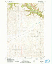
Editions of this 1969 Mondovi Map
2 editions found
Other maps of this area

1944 · Wellpinit
USGS Topo · 1:62,500

1945 · Reardan
USGS Topo · 1:62,500

1948 · Turtle Lake
USGS Topo · 1:62,500

1950 · Turtle Lake
USGS Topo · 1:62,500

1953 · Reardan
USGS Topo · 1:62,500

1953 · Wellpinit
USGS Topo · 1:62,500

1953 · Ritzville
USGS Topo · 1:250,000

1955 · Spokane
USGS Topo · 1:250,000

1958 · Spokane
USGS Topo · 1:250,000

1959 · Ritzville
USGS Topo · 1:250,000