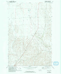
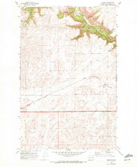
1969 Map of Bluestem
USGS Topo · Published 1993About this map
Bluestem sits at the junction of industrial activity and the rolling landscape of Lincoln County, defined by its Grain Elevators and connection to the regional agricultural economy. The map reveals a transition in transportation, notably featuring an Old Railroad Grade that winds through the terrain alongside Bluestem Creek. This rail history is mirrored by the presence of small local settlements like Negus and Post, which once served as focal points for the surrounding farmsteads. The land itself is marked by distinct geographical features such as Bruns Flat and the elongated Lords Valley, while smaller infrastructure like Storage Bins and a remote Landing Strip highlight the practical requirements of mid-century wheat country. Water sources are vital but scattered, with named points like Tanner Lake and several springs providing the necessary resources for the cattle and crops found across these sections.
Find a feature on this map
19 named features on this map. Tap any name to fly to it.
Don’t see what you’re looking for? This feature index may not catch every label — zoom into the map to look around manually.
Map Details
Editions of this 1969 Bluestem Map
2 editions found
Other maps of this area

1953 · Ritzville
USGS Topo · 1:250,000

1959 · Ritzville
USGS Topo · 1:250,000

1965 · Ritzville
USGS Topo · 1:250,000
1969 · Bluestem
USGS Topo · 1:24,000
1969 · Harrington
USGS Topo · 1:24,000
1969 · Lords Valley
USGS Topo · 1:24,000
1969 · Mondovi
USGS Topo · 1:24,000
1969 · Rocklyn
USGS Topo · 1:24,000
1969 · Omans
USGS Topo · 1:24,000
1969 · Rocklyn SE
USGS Topo · 1:24,000