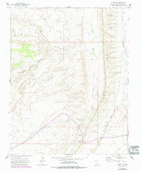
1962 Map of Bluff SW
USGS Topo · Published 1978About this map
Comb Ridge dominates this 1962 landscape in southeastern Utah, serving as a massive sandstone barrier that dictates the flow of Comb Wash and Butler Wash. This survey captures a region defined by ancient human activity and historic migration routes, most notably where the Mormon Trail crosses the high desert terrain. Numerous Cliff Dwellings are documented tucked into the alcoves of Road Canyon and the surrounding mesas, marking a deep archaeological record. The map reveals the isolation of the Barton Range and Lime Ridge, where water is a scarce and precious resource found only at sites like Navajo Spring. By 1978, photorevisions added modern infrastructure like a remote Airstrip and a Gaging Station on the wash, illustrating how 20th-century exploration and resource management began to touch this prehistoric landscape.
Find a feature on this map
20 named features on this map. Tap any name to fly to it.
Don’t see what you’re looking for? This feature index may not catch every label — zoom into the map to look around manually.
Map Details
Editions of this 1962 Bluff SW Map
3 editions found
Other maps of this area

1886 · Abajo
USGS Topo · 1:250,000

1892 · Abajo
USGS Topo · 1:250,000

1893 · Abajo
USGS Topo · 1:250,000

1956 · Cortez
USGS Topo · 1:250,000

1958 · Cortez
USGS Topo · 1:250,000

1959 · Cortez
USGS Topo · 1:250,000

1962 · Cortez
USGS Topo · 1:250,000
1962 · Bluff NW
USGS Topo · 1:24,000

1962 · Bluff
USGS Topo · 1:62,500
1962 · Bluff SW
USGS Topo · 1:24,000