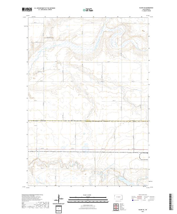
2021 Map of Blunt SE
USGS Topo · Published 2021About this map
Medicine Knoll Creek and its tributary, the South Fork Medicine Knoll Creek, carve a winding drainage pattern across this prairie landscape along the border of Sully and Hughes counties. The terrain is defined by the broad, low-lying basins of Swanson Lake and Woodruff Lake, which punctuate the southeastern portion of the map. This area represents the open ranching and agricultural country typical of central South Dakota, organized by a rigid grid of rural section roads like 191st St and Co Rd 202. The mapping detail captures the subtle hydrography of the region, including the seasonal nature of the waterways labeled as S Fork Medicine Knoll Cr. This specific topography illustrates the drainage challenges and water management patterns essential for land use in the Missouri Plateau region during the early twenty-first century.
Find a feature on this map
22 named features on this map. Tap any name to fly to it.
Don’t see what you’re looking for? This feature index may not catch every label — zoom into the map to look around manually.
Map Details
Editions of this 2021 Blunt SE Map
This is the sole edition of this map. No revisions or reprints were ever made.
Other maps of this area

1953 · Huron
USGS Topo · 1:250,000

1954 · Huron
USGS Topo · 1:250,000

1967 · Blunt
USGS Topo · 1:24,000

1967 · Blunt SE
USGS Topo · 1:24,000

1967 · De Grey NE
USGS Topo · 1:24,000
1967 · Blunt NW
USGS Topo · 1:24,000

1967 · Blunt NE
USGS Topo · 1:24,000
1967 · De Grey NW
USGS Topo · 1:24,000

1968 · Harrold NW
USGS Topo · 1:24,000

1968 · Harrold
USGS Topo · 1:24,000