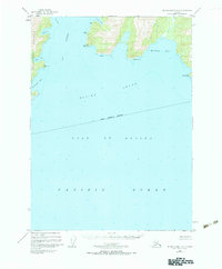
1950 Map of Blying Sound D-6
USGS Topo · Published 1987About this map
The Resurrection Peninsula and the coastal fringes of the Kenai Peninsula Borough meet the open waters of the Gulf of Alaska in this 1950 coastal study. This maritime-focused map documents the complex shoreline where Day Harbor and Blying Sound dominate the landscape. The interior remains largely unsurveyed, reflecting the era's reliance on photogrammetric methods to chart the rugged transitions from mountain to sea. Maritime landmarks like Cape Fairfield and Cape Mansfield define the entrance to Whidbey Bay, while smaller inlets like Safety Cove and Anchor Cove suggest the natural harbors sought by vessels navigating the southern Alaska coast. The map's depth soundings and coastal features such as Fault Point and the Ledge highlight the navigational hazards and geological character of this remote peninsula before modern development.
Find a feature on this map
20 named features on this map. Tap any name to fly to it.
Don’t see what you’re looking for? This feature index may not catch every label — zoom into the map to look around manually.
Map Details
Editions of this 1950 Blying Sound D-6 Map
3 editions found
Other maps of this area

1946 · Blying Sound
USGS Topo · 1:250,000

1950 · Seward A-6
USGS Topo · 1:63,360

1950 · Blying Sound D-7
USGS Topo · 1:63,360

1950 · Blying Sound D-6
USGS Topo · 1:63,360

1950 · Seward A-7
USGS Topo · 1:63,360

1950 · Blying Sound D-5
USGS Topo · 1:63,360

1951 · Blying Sound
USGS Topo · 1:250,000

1951 · Seward
USGS Topo · 1:250,000

1951 · Seward A-6
USGS Topo · 1:63,360

1951 · Seward A-7
USGS Topo · 1:63,360