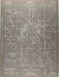
1942 Map of Blythe
USGS Topo · Published 1943About this map
Military mobilization and agricultural industry define this desert landscape along the Colorado River during the early 1940s. The map documents the presence of the Camp Poston Japanese Relocation Camp on the Arizona side of the river, while the California side reveals the infrastructure of the Army Air Base and the Martin Air Academy near Blythe. This area was a critical training ground for the War Department, evidenced by the Army Bombing Range and multiple Possible Camouflage Areas scattered across the Chuckwalla Valley and Dome Rock Mountains.
Find a feature on this map
98 named features on this map. Tap any name to fly to it.
Don’t see what you’re looking for? This feature index may not catch every label — zoom into the map to look around manually.
Map Details
Editions of this 1942 Blythe Map
2 editions found

Other maps of this area

1903 · Yuma
USGS Topo · 1:125,000

1905 · Yuma
USGS Topo · 1:125,000

1907 · Holtville
USGS Topo · 1:125,000

1911 · Parker
USGS Topo · 1:125,000

1923 · Signal
USGS Topo · 1:250,000

1928 · Norton
USGS Topo · 1:62,500

1929 · Laguna
USGS Topo · 1:62,500

1929 · Norton
USGS Topo · 1:62,500

1930 · Linskey
USGS Topo · 1:62,500

1931 · Moon Mtn
USGS Topo · 1:62,500