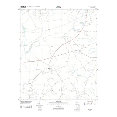
2011 Map of Blythe
USGS Topo · Published 2011About this map
Blythe serves as the primary settlement in this part of Richmond County, where the landscape is defined by the headwaters of numerous small waterways. The terrain is crisscrossed by a network of family-named landmarks and rural infrastructure, including Freeman Cemetery and the Hughes Cemetery. The distribution of water is central to the area's development, seen in features like Union Mill Pond, Gordon Lakes Dam, and Ellis Pond. Small-scale aviation has left its mark on the local geography with the Pea Patch Aerodrome and Teal Airpark located east of Bath. This map illustrates a transition where agricultural tracts meet rural residential growth, linked by historic routes like Hopson Mill Rd and County Line Rd along the banks of McBean Creek.
Find a feature on this map
68 named features on this map. Tap any name to fly to it.
Don’t see what you’re looking for? This feature index may not catch every label — zoom into the map to look around manually.
Map Details
Editions of this 2011 Blythe Map
This is the sole edition of this map. No revisions or reprints were ever made.
Other maps of this area

1919 · Gough
USGS Topo · 1:62,500

1920 · Stapleton
USGS Topo · 1:62,500

1922 · Harlem
USGS Topo · 1:62,500

1922 · Hephzibah
USGS Topo · 1:62,500

1948 · Hephzibah
USGS Topo · 1:62,500

1948 · Harlem
USGS Topo · 1:62,500

1948 · Stapleton
USGS Topo · 1:62,500

1948 · Gough
USGS Topo · 1:62,500

1948 · Blythe
USGS Topo · 1:24,000

1948 · Harlem
USGS Topo · 1:24,000