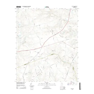
2014 Map of Blythe
USGS Topo · Published 2014About this map
Blythe and the smaller settlement of Bath anchor the landscape where the northern boundary of Burke County meets Richmond County. This area in 2014 is characterized by numerous family-named landmarks and water features, including McDonald Pond and Union Mill Pond. The terrain is drained by several branches, such as Leitners Br and Spirit Cr, which feed into larger systems like McBean Cr. Evidence of local heritage is found in numerous scattered burial grounds, such as Rachels Cem, Freeman Cem, and the Saxon Cem. Transportation across the region is facilitated by the Norfolk Southern railway and the long-established Deans Bridge Rd, which cuts diagonally across the quadrangle. A unique local landmark, the Pea Patch Aerodrome, sits south of the main road, while the Daughter of Zion Ch serves the community west of the town center.
Find a feature on this map
101 named features on this map. Tap any name to fly to it.
Don’t see what you’re looking for? This feature index may not catch every label — zoom into the map to look around manually.
Map Details
Editions of this 2014 Blythe Map
This is the sole edition of this map. No revisions or reprints were ever made.
Other maps of this area

1919 · Gough
USGS Topo · 1:62,500

1920 · Stapleton
USGS Topo · 1:62,500

1922 · Harlem
USGS Topo · 1:62,500

1922 · Hephzibah
USGS Topo · 1:62,500

1948 · Hephzibah
USGS Topo · 1:62,500

1948 · Harlem
USGS Topo · 1:62,500

1948 · Stapleton
USGS Topo · 1:62,500

1948 · Gough
USGS Topo · 1:62,500

1948 · Blythe
USGS Topo · 1:24,000

1948 · Harlem
USGS Topo · 1:24,000