
1956 Map of Blytheville
USGS Topo · Published 1964About this map
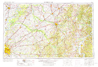
The Mississippi River and its complex system of islands, including Island No 21 and Island No 25, anchor the western edge of this mid-century survey. The landscape transitions from the river bottomlands of Mississippi Co Arkansas into the rolling uplands of West Tennessee, where a dense network of railroads like the Illinois Central RR and Gulf Mobile and Ohio RR connect major hubs like Jackson and Memphis.
Find a feature on this map
55 named features on this map. Tap any name to fly to it.
Don’t see what you’re looking for? This feature index may not catch every label — zoom into the map to look around manually.
Map Details
Editions of this 1956 Blytheville Map
2 editions found
Other maps of this area

1905 · Waynesboro
USGS Topo · 1:125,000

1911 · Iuka
USGS Topo · 1:48,000

1914 · Iuka
USGS Topo · 1:62,500

1916 · Memphis
USGS Topo · 1:62,500

1924 · Gravelly Springs
USGS Topo · 1:48,000

1925 · Memphis
USGS Topo · 1:48,000

1926 · Gravelly Springs
USGS Topo · 1:62,500

1927 · Memphis
USGS Topo · 1:62,500

1931 · Jericho
USGS Topo · 1:62,500

1932 · Horn Lake
USGS Topo · 1:48,000