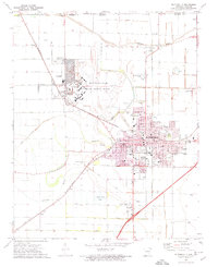
1972 Map of Blytheville
USGS Topo · Published 1974About this map
Blytheville Air Force Base dominates the northern landscape of this 1970s survey, showing its extensive runway and Firing Range adjacent to the growing community of Gosnell. The map illustrates a highly managed hydrological environment, where Pemiscot Bayou is crisscrossed by an intricate network of engineered drainage, including Ditch No 29 and Ditch No 33. These channels reflect the region's intensive agricultural history, carved into the alluvial landscape of the Mississippi Delta near the Missouri border.
Find a feature on this map
91 named features on this map. Tap any name to fly to it.
Don’t see what you’re looking for? This feature index may not catch every label — zoom into the map to look around manually.
Map Details
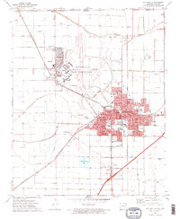
Editions of this 1972 Blytheville Map
2 editions found
Other maps of this area

1934 · Kennett
USGS Topo · 1:62,500

1939 · Blytheville
USGS Topo · 1:62,500

1940 · Kennett
USGS Topo · 1:62,500

1940 · Hayti
USGS Topo · 1:62,500

1941 · Manila
USGS Topo · 1:62,500

1953 · Memphis
USGS Topo · 1:250,000

1955 · Hayti
USGS Topo · 1:62,500

1955 · Blytheville
USGS Topo · 1:62,500

1956 · Kennett
USGS Topo · 1:62,500

1956 · Manila
USGS Topo · 1:62,500