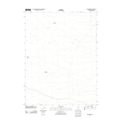
2011 Map of Bob Spring
USGS Topo · Published 2011About this map
Sahwave Mountains dominate the central landscape of this Pershing County region, where the terrain is defined by dry washes and high ridges. The map records a series of critical water sources essential for life in this arid environment, specifically Bob Spring and South Juniper Spring. To the north, Juniper Mountain rises as a prominent landmark, while the western edge is bounded by the Granite Springs Ridge. The 2011 survey reflects the sparse road network of this area, showing only a few trails and primitive roads crossing the desert floor, emphasizing the isolation of these mountain ranges.
Find a feature on this map
5 named features on this map. Tap any name to fly to it.
Don’t see what you’re looking for? This feature index may not catch every label — zoom into the map to look around manually.
Map Details
Editions of this 2011 Bob Spring Map
This is the sole edition of this map. No revisions or reprints were ever made.
Other maps of this area

1886 · Granite Range
USGS Topo · 1:250,000

1894 · Granite Range
USGS Topo · 1:250,000

1931 · Lovelock
USGS Topo · 1:250,000

1935 · Lovelock
USGS Topo · 1:250,000

1955 · Lovelock
USGS Topo · 1:250,000

1959 · Lovelock
USGS Topo · 1:250,000
1981 · Bluewing Flat South
USGS Topo · 1:24,000
1981 · Tunnel Spring
USGS Topo · 1:24,000

1981 · Bluewing Flat North
USGS Topo · 1:24,000
1981 · Sage Hen Spring
USGS Topo · 1:24,000