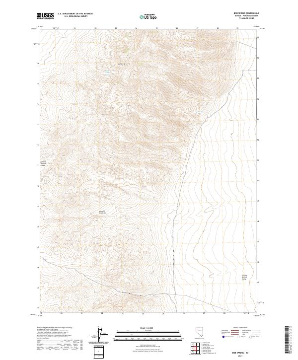
2021 Map of Bob Spring
USGS Topo · Published 2021About this map
The Sahwave Mountains define this high-desert landscape in Pershing County, where elevation changes reveal the isolated character of the Great Basin. This recent survey by the U.S. Geological Survey details a region defined by arid ranges and the broad Granite Springs Valley to the east. Water sources remain critical landmarks for navigation and local history in such a dry climate, with Bob Spring and South Juniper Spring providing vital points of reference tucked among the slopes of Juniper Mtn. The topography is further shaped by the Granite Springs Ridge, illustrating the classic basin-and-range structure typical of this part of Nevada. While the area lacks dense modern development, the map serves as a precise guide to the natural terrain and the township and range boundaries that organize this remote desert interior.
Find a feature on this map
15 named features on this map. Tap any name to fly to it.
Don’t see what you’re looking for? This feature index may not catch every label — zoom into the map to look around manually.
Map Details
Editions of this 2021 Bob Spring Map
This is the sole edition of this map. No revisions or reprints were ever made.
Other maps of this area

1886 · Granite Range
USGS Topo · 1:250,000

1894 · Granite Range
USGS Topo · 1:250,000

1931 · Lovelock
USGS Topo · 1:250,000

1935 · Lovelock
USGS Topo · 1:250,000

1955 · Lovelock
USGS Topo · 1:250,000

1959 · Lovelock
USGS Topo · 1:250,000
1981 · Bluewing Flat South
USGS Topo · 1:24,000
1981 · Tunnel Spring
USGS Topo · 1:24,000

1981 · Bluewing Flat North
USGS Topo · 1:24,000
1981 · Sage Hen Spring
USGS Topo · 1:24,000