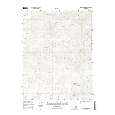
2017 Map of Bobby Canyon North
USGS Topo · Published 2017About this map
Bobby Canyon and its surrounding high-desert plateau are defined by a complex network of seasonal drainages and named topographic benches in this modern U.S. Geological Survey record. The area is marked by a transition from the lower Poverty Bench and Coal Creek Bench in the north to a series of deeply incised canyons that drain the landscape southward. One of the few marked water sources, Oak Spring, is located on the eastern edge of the quadrangle, suggesting the importance of localized springs in this arid environment. Names like Flat Nose George Canyon and Winter Camp Canyon hint at the area's history of range use and early exploration. The map also captures the intricate branching of Naylon Canyon, showing the Right Fork Naylon Canyon and Left Fork Naylon Canyon as they carve through the high ground towards Left Hand Tusher Canyon.
Find a feature on this map
17 named features on this map. Tap any name to fly to it.
Don’t see what you’re looking for? This feature index may not catch every label — zoom into the map to look around manually.
Map Details
Editions of this 2017 Bobby Canyon North Map
This is the sole edition of this map. No revisions or reprints were ever made.
Other maps of this area

1885 · East Tavaputs
USGS Topo · 1:250,000

1886 · Price River
USGS Topo · 1:250,000

1896 · Price River
USGS Topo · 1:250,000

1954 · Range Creek
USGS Topo · 1:62,500

1956 · Price
USGS Topo · 1:250,000

1956 · Grand Junction
USGS Topo · 1:250,000

1959 · Grand Junction
USGS Topo · 1:250,000

1960 · Price
USGS Topo · 1:250,000

1960 · Grand Junction
USGS Topo · 1:250,000

1962 · Grand Junction
USGS Topo · 1:250,000