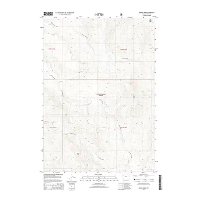
2015 Map of Bobcat Ridge
USGS Topo · Published 2015About this map
Bobcat Ridge and Pinyon Peak dominate this high-elevation backcountry within the Teton National Forest. The landscape is defined by a dense network of watercourses and primitive routes, including the Wolverine Creek Trail and the Whetstone Trail. These paths trace the drainages of Wolverine Creek, Pilgrim Creek, and Coulter Creek, illustrating the remote wilderness character of this portion of Wyoming. The connectivity between high points like Big Game Ridge and the lower stream valleys is maintained by established routes such as the Wolverine Cutoff and Colter Creek Trail. This survey captures the drainage patterns of both the West Whetstone Creek and East Whetstone Creek, providing a detailed look at the headwaters that feed into the larger regional watershed.
Find a feature on this map
19 named features on this map. Tap any name to fly to it.
Don’t see what you’re looking for? This feature index may not catch every label — zoom into the map to look around manually.
Map Details
Editions of this 2015 Bobcat Ridge Map
This is the sole edition of this map. No revisions or reprints were ever made.
Other maps of this area

1885 · Lake
USGS Topo · 1:125,000

1886 · Shoshone
USGS Topo · 1:125,000

1888 · Shoshone
USGS Topo · 1:125,000

1895 · Shoshone
USGS Topo · 1:125,000

1895 · Lake
USGS Topo · 1:125,000

1896 · Lake
USGS Topo · 1:125,000

1899 · Grand Teton
USGS Topo · 1:125,000

1901 · Shoshone
USGS Topo · 1:125,000

1901 · Lake
USGS Topo · 1:125,000

1901 · Grand Teton
USGS Topo · 1:125,000