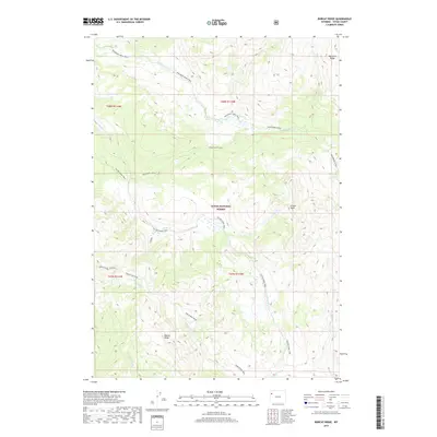
2017 Map of Bobcat Ridge
USGS Topo · Published 2017About this map
Bobcat Ridge and its surrounding high-country terrain define this 2017 study of Teton National Forest. This high-altitude landscape is characterized by a complex drainage system where Wolverine Cr and Coulter Cr carve through the wilderness between Pinyon Peak and the northern extent of Big Game Ridge. The map documents a sparse but vital network of backcountry routes, including the Wolverine Creek Trail and the Colter Creek Trail, which provide the primary access to these remote reaches of Teton County. Further south, the map details the headwaters of Pilgrim Cr and the branching paths of the Whetstone Trail. The placement of the Wolverine Cutoff suggests a historical reliance on these specific ridge-top and valley-floor corridors for movement through the timbered Wyoming interior.
Find a feature on this map
20 named features on this map. Tap any name to fly to it.
Don’t see what you’re looking for? This feature index may not catch every label — zoom into the map to look around manually.
Map Details
Editions of this 2017 Bobcat Ridge Map
This is the sole edition of this map. No revisions or reprints were ever made.
Other maps of this area

1885 · Lake
USGS Topo · 1:125,000

1886 · Shoshone
USGS Topo · 1:125,000

1888 · Shoshone
USGS Topo · 1:125,000

1895 · Shoshone
USGS Topo · 1:125,000

1895 · Lake
USGS Topo · 1:125,000

1896 · Lake
USGS Topo · 1:125,000

1899 · Grand Teton
USGS Topo · 1:125,000

1901 · Shoshone
USGS Topo · 1:125,000

1901 · Lake
USGS Topo · 1:125,000

1901 · Grand Teton
USGS Topo · 1:125,000