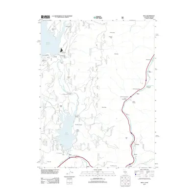
2012 Map of Boca
USGS Topo · Published 2012About this map
The Truckee River corridor defines this portion of the Sierra Nevada, where the water's path dictates the placement of early 21st-century infrastructure and historic settlements. Significant water management is evident through the presence of the Boca Reservoir and Stampede Reservoir, which dominate the western half of the landscape. Along the narrow river canyon to the east, small communities and industrial sites like Floriston and the Farad Powerhouse cling to the banks, connected by the rail line and interstate that follow the river's bend toward Nevada.
Find a feature on this map
55 named features on this map. Tap any name to fly to it.
Don’t see what you’re looking for? This feature index may not catch every label — zoom into the map to look around manually.
Map Details
Editions of this 2012 Boca Map
This is the sole edition of this map. No revisions or reprints were ever made.
Other maps of this area

1890 · Sierraville
USGS Topo · 1:125,000

1891 · Carson
USGS Topo · 1:125,000

1891 · Truckee
USGS Topo · 1:125,000

1891 · Reno
USGS Topo · 1:125,000

1892 · Sierraville
USGS Topo · 1:125,000

1893 · Carson
USGS Topo · 1:125,000

1893 · Truckee
USGS Topo · 1:125,000

1893 · Reno
USGS Topo · 1:125,000

1894 · Sierraville
USGS Topo · 1:125,000

1895 · Truckee
USGS Topo · 1:125,000