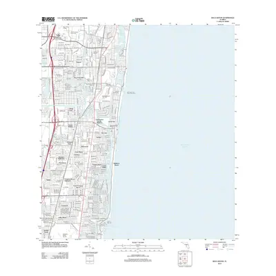
2012 Map of Boca Raton
USGS Topo · Published 2012About this map
Florida Atlantic University and the Boca Raton Airport dominate the northwestern landscape of this coastal survey, reflecting the significant institutional and infrastructure development in this part of Broward and Palm Beach counties. The map captures a densely settled suburban corridor characterized by a complex network of neighborhoods such as Floresta, Royal Oak Hills, and North Pompano Beach. This residential growth is bound by the Florida East Coast Railway and a series of vital waterways, including the Hillsboro Canal and the Hillsboro River.
Find a feature on this map
167 named features on this map. Tap any name to fly to it.
Don’t see what you’re looking for? This feature index may not catch every label — zoom into the map to look around manually.
Map Details
Editions of this 2012 Boca Raton Map
This is the sole edition of this map. No revisions or reprints were ever made.
Other maps of this area

1945 · Fort Lauderdale North
USGS Topo · 1:24,000

1946 · West Dixie Bend
USGS Topo · 1:24,000

1946 · Boca Raton
USGS Topo · 1:24,000

1947 · Delmar Farms
USGS Topo · 1:24,000

1949 · Fort Lauderdale North
USGS Topo · 1:24,000

1949 · West Dixie Bend
USGS Topo · 1:24,000

1949 · Pompano Beach
USGS Topo · 1:24,000

1949 · Delmar Farms
USGS Topo · 1:24,000

1950 · Boca Raton
USGS Topo · 1:24,000

1950 · Delray Beach
USGS Topo · 1:24,000