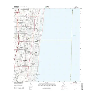
2015 Map of Boca Raton
USGS Topo · Published 2015About this map
Deerfield Beach and Pompano Beach anchor this coastal survey, showcasing the dense residential and maritime development along Florida's southeastern shore during the mid-2010s. The landscape is defined by its complex water management and transit systems, where the Intracoastal Waterway and Hillsboro Canal intersect with established neighborhoods like Royal Oak Hills, The Cove, and Shorewood. Aviation history and infrastructure are prominent, with the Boca Raton Airport in the north and the Pompano Beach Airpark in the south serving the region. The map captures the tight integration of land and sea, marked by engineering features such as the Haven Ashe Bridge and Deerfield Beach Bridge, which facilitate movement across the barrier islands. Genealogists and local historians can locate smaller communities like Carver Heights and Kendall Green, alongside the Boca Raton Cem, providing a precise record of the area's modern footprint.
Find a feature on this map
58 named features on this map. Tap any name to fly to it.
Don’t see what you’re looking for? This feature index may not catch every label — zoom into the map to look around manually.
Map Details
Editions of this 2015 Boca Raton Map
This is the sole edition of this map. No revisions or reprints were ever made.
Other maps of this area

1945 · Fort Lauderdale North
USGS Topo · 1:24,000

1946 · West Dixie Bend
USGS Topo · 1:24,000

1946 · Boca Raton
USGS Topo · 1:24,000

1947 · Delmar Farms
USGS Topo · 1:24,000

1949 · Fort Lauderdale North
USGS Topo · 1:24,000

1949 · West Dixie Bend
USGS Topo · 1:24,000

1949 · Pompano Beach
USGS Topo · 1:24,000

1949 · Delmar Farms
USGS Topo · 1:24,000

1950 · Boca Raton
USGS Topo · 1:24,000

1950 · Delray Beach
USGS Topo · 1:24,000