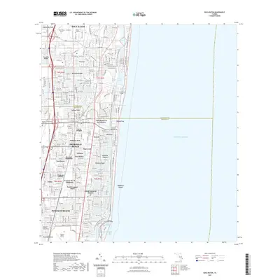
2021 Map of Boca Raton
USGS Topo · Published 2021About this map
Boca Raton, Deerfield Beach, and Pompano Beach anchor this 2021 coastal survey, showing the dense residential and maritime development along Florida's Atlantic coast. The map illustrates a complex network of waterways, including the Intracoastal Waterway and the Hillsboro Canal, which defines the boundary between Palm Beach and Broward counties. Large institutions such as Florida Atlantic University and the Boca Raton Airport dominate the northern landscape, while specialized enclaves like Little Harbor on the Hillsboro and The Cove highlight the area's canal-front character.
Find a feature on this map
62 named features on this map. Tap any name to fly to it.
Don’t see what you’re looking for? This feature index may not catch every label — zoom into the map to look around manually.
Map Details
Editions of this 2021 Boca Raton Map
This is the sole edition of this map. No revisions or reprints were ever made.
Other maps of this area

1945 · Fort Lauderdale North
USGS Topo · 1:24,000

1946 · West Dixie Bend
USGS Topo · 1:24,000

1946 · Boca Raton
USGS Topo · 1:24,000

1947 · Delmar Farms
USGS Topo · 1:24,000

1949 · Fort Lauderdale North
USGS Topo · 1:24,000

1949 · West Dixie Bend
USGS Topo · 1:24,000

1949 · Pompano Beach
USGS Topo · 1:24,000

1949 · Delmar Farms
USGS Topo · 1:24,000

1950 · Boca Raton
USGS Topo · 1:24,000

1950 · Delray Beach
USGS Topo · 1:24,000