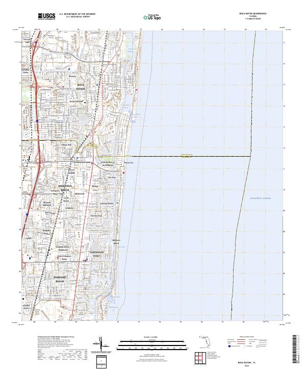
2024 Map of Boca Raton
USGS Topo · Published 2024About this map
The coastal transition between Palm Beach and Broward counties is defined by a dense network of waterways and residential neighborhoods. Along the northern edge, Florida Atlantic University and the Boca Raton Airport anchor a modern landscape of organized subdivisions such as Royal Oak Hills and Floresta. The Intracoastal Waterway runs parallel to the shore, connecting Lake Wyman, Lake Boca Raton, and Lake Placid before exiting to the Atlantic Ocean at the Boca Raton Inlet and Hillsboro Inlet.
Find a feature on this map
56 named features on this map. Tap any name to fly to it.
Don’t see what you’re looking for? This feature index may not catch every label — zoom into the map to look around manually.
Map Details
Editions of this 2024 Boca Raton Map
This is the sole edition of this map. No revisions or reprints were ever made.
Historical Maps of Arlington Park Through Time
4 maps found