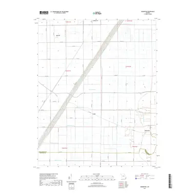
2017 Map of Boekerton
USGS Topo · Published 2017About this map
Tallapoosa and the small agricultural clusters of Hartzell and Frailie anchor this section of the Missouri Bootheel, a landscape defined by an extensive drainage network. The engineering of the land is evident in the numbered canals, such as Ditch Number 57 and Ditch Number 59, which redirected water to create productive farmland. Near the settlement of Boekerton, the natural course of the Little River and the Portage Open Bay break the rigid grid of section lines and drainage ditches.
Find a feature on this map
58 named features on this map. Tap any name to fly to it.
Don’t see what you’re looking for? This feature index may not catch every label — zoom into the map to look around manually.
Map Details
Editions of this 2017 Boekerton Map
This is the sole edition of this map. No revisions or reprints were ever made.
Other maps of this area

1939 · Portageville
USGS Topo · 1:62,500

1939 · New Madrid
USGS Topo · 1:62,500

1940 · Malden
USGS Topo · 1:62,500

1940 · Pascola
USGS Topo · 1:62,500

1954 · New Madrid
USGS Topo · 1:62,500

1955 · Pascola
USGS Topo · 1:62,500

1955 · Portageville
USGS Topo · 1:62,500

1956 · Malden
USGS Topo · 1:62,500

1956 · Dyersburg
USGS Topo · 1:250,000
1971 · Catron
USGS Topo · 1:24,000