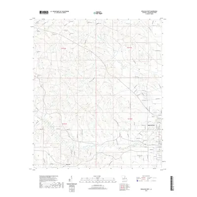
2020 Map of Bogalusa West
USGS Topo · Published 2020About this map
Bogalusa serves as the eastern anchor of this Washington Parish study, where the residential streets and grid of the city give way to the wooded, creek-fed terrain of the Florida Parishes. The landscape is defined by the winding course of Bogue Lusa Cr and its numerous tributaries, including Ice Water Br and Yellow Br. These watercourses dictated the early settlement patterns of the region, which remain evident in the placement of numerous family and community burial grounds such as McGehee Cem and Corkern Cem. To the west, the rural community of Plainview and the vicinity of Jacksonville Springs represent the enduring agrarian character of the area outside the urban center. The map documents an extensive network of parish roads that follow the high ground between drainages like Coburn Cr and Peters Cr, providing a detailed look at the rural infrastructure in the early twenty-first century.
Find a feature on this map
101 named features on this map. Tap any name to fly to it.
Don’t see what you’re looking for? This feature index may not catch every label — zoom into the map to look around manually.
Map Details
Editions of this 2020 Bogalusa West Map
This is the sole edition of this map. No revisions or reprints were ever made.
Other maps of this area

1939 · Zona
USGS Topo · 1:31,680

1942 · Thigpen
USGS Topo · 1:31,680

1942 · Rio
USGS Topo · 1:31,680

1942 · Pools Bluff
USGS Topo · 1:31,680

1942 · Thomas
USGS Topo · 1:31,680

1949 · Bogalusa East
USGS Topo · 1:31,680

1949 · Angie
USGS Topo · 1:31,680

1949 · Bogalusa West
USGS Topo · 1:31,680

1950 · Crains Creek
USGS Topo · 1:31,680

1953 · Mobile
USGS Topo · 1:250,000