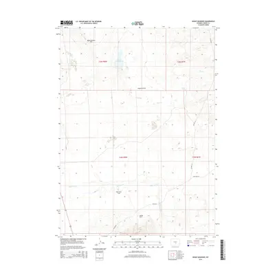
2015 Map of Boggy Meadows
USGS Topo · Published 2015About this map
Boggy Meadows Rim defines the northern reaches of this high-altitude landscape in Carbon County, where the terrain transitions into the broad expanse of Boggy Meadows. The hydrology of the area is centered on Boggy Meadows Lake and the drainage of Stone Cr, while further south, the land levels out into the Separation Flats. This 2015 survey illustrates a sparsely populated region of Wyoming primarily shaped by ranching and resource management, evidenced by the network of unpaved tracks such as Willow Rd and Stone Ranch Rd. Rendle Spring and the winding course of Separation Cr provide critical water sources in an otherwise arid environment, punctuated by the deep incision of Rendle Draw to the south.
Find a feature on this map
51 named features on this map. Tap any name to fly to it.
Don’t see what you’re looking for? This feature index may not catch every label — zoom into the map to look around manually.
Map Details
Editions of this 2015 Boggy Meadows Map
This is the sole edition of this map. No revisions or reprints were ever made.
Other maps of this area

1953 · Ferris
USGS Topo · 1:24,000

1953 · Riddle Cut
USGS Topo · 1:24,000

1953 · Rawlins NW
USGS Topo · 1:24,000

1954 · Rawlins
USGS Topo · 1:250,000

1955 · Casper
USGS Topo · 1:250,000

1956 · Rawlins Peak
USGS Topo · 1:62,500

1958 · Rawlins
USGS Topo · 1:250,000

1958 · Casper
USGS Topo · 1:250,000

1960 · Separation Rim
USGS Topo · 1:24,000

1960 · Boggy Meadows
USGS Topo · 1:24,000