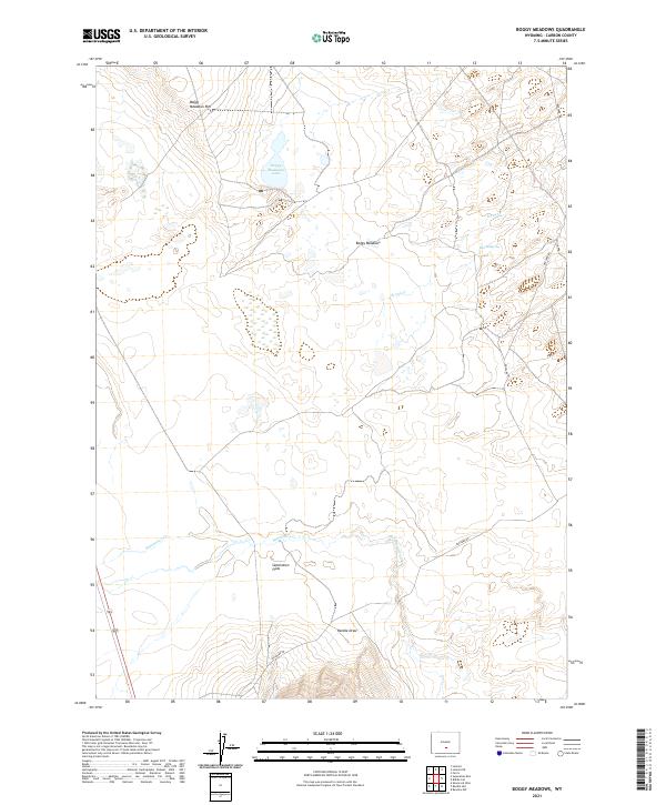
2021 Map of Boggy Meadows
USGS Topo · Published 2021About this map
Boggy Meadows and the expansive Separation Flats define this high-altitude landscape in Carbon County, where the high desert meets the drainages of the Continental Divide. The terrain is characterized by a series of north-to-south watercourses, including the meanders of Separation Cr and the intermittent flow of Stone Cr. Elevation shifts are most prominent along the Boggy Meadows Rim, which overlooks the seasonal waters of Boggy Meadows Lake. A network of unpaved tracks, most notably Buzzard Rd, provides the primary access through this sparsely populated ranching and grazing country. Significant water sources for local operations are marked by features like Rendle Spring and the drainage of Rendle Draw, reflecting the essential relationship between geography and survival in this arid environment during the early 21st century.
Find a feature on this map
14 named features on this map. Tap any name to fly to it.
Don’t see what you’re looking for? This feature index may not catch every label — zoom into the map to look around manually.
Map Details
Editions of this 2021 Boggy Meadows Map
This is the sole edition of this map. No revisions or reprints were ever made.
Other maps of this area

1953 · Ferris
USGS Topo · 1:24,000

1953 · Riddle Cut
USGS Topo · 1:24,000

1953 · Rawlins NW
USGS Topo · 1:24,000

1954 · Rawlins
USGS Topo · 1:250,000

1955 · Casper
USGS Topo · 1:250,000

1956 · Rawlins Peak
USGS Topo · 1:62,500

1958 · Rawlins
USGS Topo · 1:250,000

1958 · Casper
USGS Topo · 1:250,000

1960 · Separation Rim
USGS Topo · 1:24,000

1960 · Boggy Meadows
USGS Topo · 1:24,000