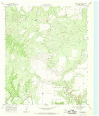
1968 Map of Boiling Spring
USGS Topo · Published 1970About this map
The North Wichita River and its southern counterpart, the Wichita R, dominate the drainage patterns of this Foard County landscape. The topography is defined by the sharp erosion of creek beds cutting through the Texas plains, most notably around the settlement of Boiling Spring. This area shows a complex network of seasonal waterways, including the descriptively named Blue Hole Creek and the bifurcated paths of Good Creek and Little Good Creek. The map documents a period of land management where fence lines and unimproved roads carve through the breaks and draws leading down to the river bottoms, reflecting the ranching character of the region in the late 1960s.
Find a feature on this map
6 named features on this map. Tap any name to fly to it.
Don’t see what you’re looking for? This feature index may not catch every label — zoom into the map to look around manually.
Map Details
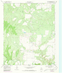
Editions of this 1968 Boiling Spring Map
2 editions found
Other maps of this area

1932 · Vivian
USGS Topo · 1:62,500

1954 · Lubbock
USGS Topo · 1:250,000

1954 · Plainview
USGS Topo · 1:250,000

1954 · Wichita Falls
USGS Topo · 1:250,000

1955 · Lawton
USGS Topo · 1:250,000

1958 · Wichita Falls
USGS Topo · 1:250,000

1958 · Plainview
USGS Topo · 1:250,000

1960 · Teacup Mountain
USGS Topo · 1:62,500

1966 · Truscott North
USGS Topo · 1:24,000

1966 · Big Four Ranch
USGS Topo · 1:24,000