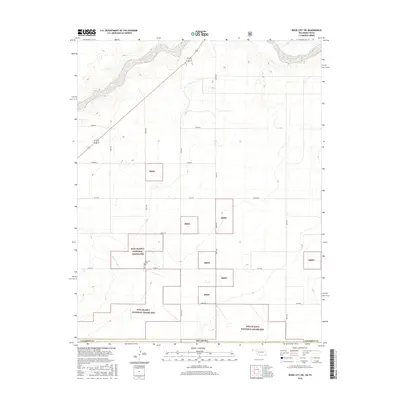
2016 Map of Boise City SW
USGS Topo · Published 2016About this map
Rita Blanca National Grassland dominates the landscape of this high plains region, where the scattered parcels of the Rbng reflect the complex history of land recovery following the Dust Bowl era. The terrain is defined by the winding course of the Beaver River and the drainage of Aqua Fria Cr, revealing the vital role of water in this arid Oklahoma Panhandle environment. A single point of historical permanence, the Bertrand Cem, sits near the center of the sheet, providing a primary point of interest for genealogists tracing early families in Cimarron County. The map reveals a highly structured grid of section roads, such as N0170 Rd and E0320 Rd, which slice through the open range and managed grasslands of the western edge of Oklahoma.
Find a feature on this map
18 named features on this map. Tap any name to fly to it.
Don’t see what you’re looking for? This feature index may not catch every label — zoom into the map to look around manually.
Map Details
Editions of this 2016 Boise City SW Map
This is the sole edition of this map. No revisions or reprints were ever made.
Other maps of this area

1954 · Dalhart
USGS Topo · 1:250,000

1958 · Dalhart
USGS Topo · 1:250,000

1962 · Dalhart
USGS Topo · 1:250,000

1969 · Boise City
USGS Topo · 1:24,000

1969 · Boise City NW
USGS Topo · 1:24,000

1969 · Boise City SW
USGS Topo · 1:24,000

1969 · Felt
USGS Topo · 1:24,000

1969 · Boise City SE
USGS Topo · 1:24,000

1969 · Felt NE
USGS Topo · 1:24,000

1973 · Buffalo Springs
USGS Topo · 1:24,000