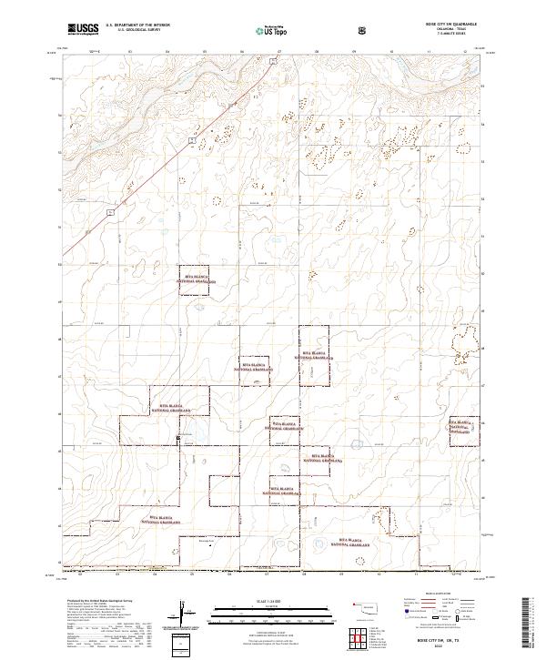
2022 Map of Boise City SW
USGS Topo · Published 2022About this map
Rita Blanca National Grassland dominates this portion of the Oklahoma Panhandle, where the high plains terrain is carved by the meandering path of the Beaver River. The landscape is defined by the rigid grid of the Public Land Survey System, with section lines and unpaved routes like N0170 Rd and E0310 Rd providing the only structural breaks in the shortgrass prairie. For genealogists and local historians, the presence of isolated burial sites like Bertrand Cem and Rammage Cem offers a tangible link to the early families who homesteaded this corner of Cimarron County. These small markers, preserved amidst the federally managed grasslands, signify the enduring legacy of the Dust Bowl era and the subsequent land reclamation efforts that shaped the modern geography of the region.
Find a feature on this map
23 named features on this map. Tap any name to fly to it.
Don’t see what you’re looking for? This feature index may not catch every label — zoom into the map to look around manually.
Map Details
Editions of this 2022 Boise City SW Map
This is the sole edition of this map. No revisions or reprints were ever made.
Other maps of this area

1954 · Dalhart
USGS Topo · 1:250,000

1958 · Dalhart
USGS Topo · 1:250,000

1962 · Dalhart
USGS Topo · 1:250,000

1969 · Boise City
USGS Topo · 1:24,000

1969 · Boise City NW
USGS Topo · 1:24,000

1969 · Boise City SW
USGS Topo · 1:24,000

1969 · Felt
USGS Topo · 1:24,000

1969 · Boise City SE
USGS Topo · 1:24,000

1969 · Felt NE
USGS Topo · 1:24,000

1973 · Buffalo Springs
USGS Topo · 1:24,000